- Shopping, made easy.
- /
- Get the app!
Find the path to your next big catch with the incredible accuracy and detail of Humminbird CoastMaster Premium Northeast Coastal Map SD Card for fish finders, providing highly accurate chart coverage for northeastern waters. This premium cartography is compatible with all Humminbird SOLIX units, APEX units, and XPLORE units. The 2D Shaded Relief feature makes bottom detail and depth changes easy to spot, helping you quickly identify potential fish-holding areas. Navigate with confidence using high-quality Aerial Imagery that improves visibility and helps locate new fishing spots. VX Technology delivers exceptional map performance with customizable color palettes to suit your viewing preferences. The Depth Highlight feature allows you to target specific depth ranges where fish are active, while the Shallow Water Highlight uses easy-to-see red shading to mark areas from 0 to 60 feet. Water Level Offset synchronizes depth contours and shorelines with actual water levels for improved accuracy. Chart Presets make it simple to switch between your custom view settings, adapting the display to different fishing scenarios. From easy-to-read contours to highlighted depth ranges, this comprehensive mapping solution provides the tools you need to identify productive fishing spots and navigate northeastern coastal waters safely. Preview coverage by downloading the One-Boat Network App for a free 30-day trial ($24.99/year after, cancel anytime). Includes 1-Year Cartography Warranty.
 -9%
Humminbird 410170-1 PIRANHAMAX 4 PT (Portable) Fish Finder
KWD 75.500
-9%
Humminbird 410170-1 PIRANHAMAX 4 PT (Portable) Fish Finder
KWD 75.500
 -8%
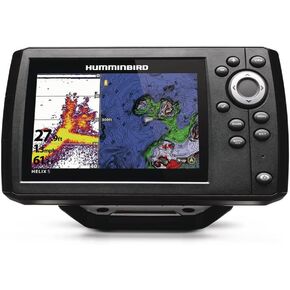
Humminbird 411660-1 Helix 5 Chirp GPS G3 Fish Finder
KWD 121
-8%
Humminbird 411660-1 Helix 5 Chirp GPS G3 Fish Finder
KWD 121
 -26%
Humminbird 710275-1 XP 9 HW In-Hull Transducer
KWD 36.500
-26%
Humminbird 710275-1 XP 9 HW In-Hull Transducer
KWD 36.500
 -10%
Humminbird 410160-1 PIRANHAMAX 4 DI (Down Imaging) Fish Finder, Black
KWD 64.500
-10%
Humminbird 410160-1 PIRANHAMAX 4 DI (Down Imaging) Fish Finder, Black
KWD 64.500


