- Shopping, made easy.
- /
- Get the app!

Kentucky Lake-North (Kentucky Dam to KY/TN Line) Fishing Map
 -24%
Gogebic Fishing Map, Lake
KWD 6.500
-24%
Gogebic Fishing Map, Lake
KWD 6.500
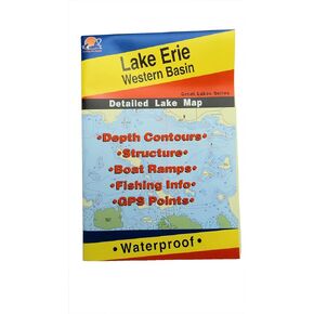 Lake Erie Western Basin Map, GPS Points, Waterproof Detailed Lake Map - #L127
KWD 6
Lake Erie Western Basin Map, GPS Points, Waterproof Detailed Lake Map - #L127
KWD 6
 -7%
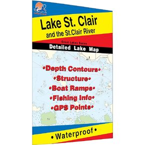
St. Clair/St. Clair River Fishing Map, Lake (MI/ONT)
KWD 6.500
-7%
St. Clair/St. Clair River Fishing Map, Lake (MI/ONT)
KWD 6.500
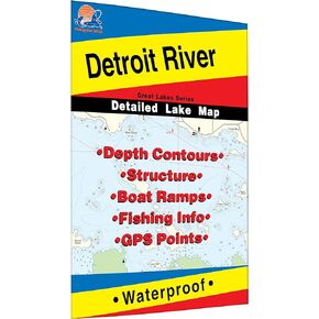 Detroit River Fishing Map
KWD 7
Detroit River Fishing Map
KWD 7