The RPLIDAR S3 is based on the laser flight-of-time (TOF) ranging principle and adopts the high-speed laser acquisition and processing hardware. The system ranges more than 32000 times per second. During every ranging process, the RPLIDAR emits modulated infrared laser signal, which is then reflected by the object to be detected.
The RPLIDAR S3 is a next-generation low-cost 360 degree 2D laser scanner (LIDAR) solution. It can take up to 32000 samples of laser ranging per second with high rotation speed. Equipped with contactless power and signal transmission technology, it breaks the life limitation of traditional LIDAR systems to work stably for a long time.
The RPLIDAR S3 is a 2D laser scanner, which can perform a 2D 360-degree scan within a 40-meter range and produce a 2D point cloud map of the space where it is located. The generated 2D point cloud data can be used in mapping, robot localization, robot navigation, and object/environment modeling.
Compared with other RPLIDAR series, RPLIDAR S3 has a more stable performance when detecting objects in long distances, objects in white or black alternatively, and objects under direct sunlight, which is ideal for map building in the outdoor or indoor environment within a 40-meter ranging radius. Therefore, it can be widely applied in many consumer-oriented business scenarios.
The typical scanning frequency of RPLIDAR S3 is 10Hz (600rpm). With the 10Hz scanning frequency, the sample rate is 32KHz, and the angular resolution is 0.1125°.


 Install Bay ABS316 ABS Universal 12 X 12 X 3/16 Inch Each (Pack of 2)
KWD 4.500
Install Bay ABS316 ABS Universal 12 X 12 X 3/16 Inch Each (Pack of 2)
KWD 4.500
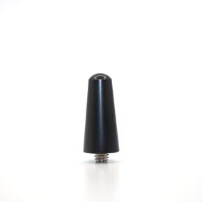 Universal Car Antenna Delet Replacement short 1.2 inch, AM/FM Roof Mount Car Radio Antenna Mast, Aluminum Antenna with M4 M5 M6 Threaded Adapter (1.2 inch)
KWD 3.500
Universal Car Antenna Delet Replacement short 1.2 inch, AM/FM Roof Mount Car Radio Antenna Mast, Aluminum Antenna with M4 M5 M6 Threaded Adapter (1.2 inch)
KWD 3.500
 METRA - Tour-Pak Rear Speaker Harness (BC-9727)
KWD 22.500
METRA - Tour-Pak Rear Speaker Harness (BC-9727)
KWD 22.500
 uxcell Ceiling Fan Capacitor CBB61 0.8uF 450V AC 2 Wires Metalized Polypropylene Film Capacitors 36.5x11x24.5mm for Water Pump Motor Generator, Pack of 10
KWD 6.500
uxcell Ceiling Fan Capacitor CBB61 0.8uF 450V AC 2 Wires Metalized Polypropylene Film Capacitors 36.5x11x24.5mm for Water Pump Motor Generator, Pack of 10
KWD 6.500


