- Shopping, made easy.
- /
- Get the app!
This is a 23x34 Inch Unframed reproduction of the Polar Azimuthal Equidistant Projection Map. Text indicating Global war strategy map, Airline distances, and Explanation of projection. This map is printed on premium 36lb matte paper with fade resistant, premium inks and includes a white border on all sides to allow for matting and framing.
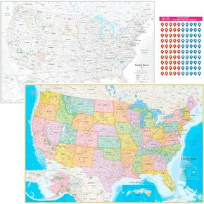 NOWMAP AquaShield Double-Sided United States, USA Map Waterproof Poster 24x36 - Folded with (Pin Stickers)
KWD 9
NOWMAP AquaShield Double-Sided United States, USA Map Waterproof Poster 24x36 - Folded with (Pin Stickers)
KWD 9
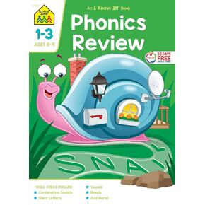 School Zone - Phonics Review 1-3 Workbook - 64 Pages, Ages 6 to 9, Grades 1 to 3, Combination Sounds, Short Letters, Vowels, and More (School Zone I Know It!® Workbook Series)
KWD 2
School Zone - Phonics Review 1-3 Workbook - 64 Pages, Ages 6 to 9, Grades 1 to 3, Combination Sounds, Short Letters, Vowels, and More (School Zone I Know It!® Workbook Series)
KWD 2
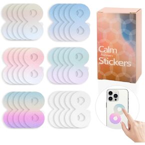 Calm Strips for Anxiety Sensory Stickers 50pcs and Spiky Sensory Rings 10pcs Special Sensory Stickers Two Texured Calming Strips Combined with Breathing (Colorful)
KWD 4.500
Calm Strips for Anxiety Sensory Stickers 50pcs and Spiky Sensory Rings 10pcs Special Sensory Stickers Two Texured Calming Strips Combined with Breathing (Colorful)
KWD 4.500
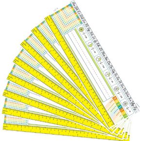 Multiplication Desk Reference Nameplates Math Traditional Manuscript Name Plate Self Adhesive for Students Pack of 36
KWD 3.500
Multiplication Desk Reference Nameplates Math Traditional Manuscript Name Plate Self Adhesive for Students Pack of 36
KWD 3.500


