Discover the rich landscape and cultural heritage of Israel with this beautifully illustrated map. Designed with clarity and detail in mind, it features major cities, physical terrain, and pictorial highlights of key historical and religious landmarks such as Bethlehem, Masada, Nazareth, and the Dome of the Rock.
With vibrant colors and clearly labeled locations, this map serves as an engaging visual guide—perfect for educational settings, travel inspiration, or personal exploration of Israel's geography and history.
Detailed depictions of Israel's geography, cities, and notable sites
Pictorial illustrations of iconic landmarks and destinations
Clear, easy-to-read labeling and vivid color palette
Printed on premium-quality paper and finished with a durable gloss laminate
Size: 59.4 x 42 cm (23.4 x 16.5 in) — ideal for framing, studying, or gifting
Perfect for educators, travelers, genealogists, and anyone with a connection to or interest in the land and history of Israel.
 Oregon State Map - 23.3 x 16.5 inches – Paper Laminated
KWD 10.500
Oregon State Map - 23.3 x 16.5 inches – Paper Laminated
KWD 10.500
 -24%
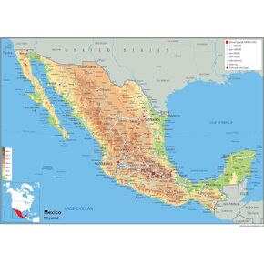
Mexico Physical Map - 16.53 x 23.38 inches - Paper Laminated
KWD 8
-24%
Mexico Physical Map - 16.53 x 23.38 inches - Paper Laminated
KWD 8
 -24%
Mississippi State Physical Poster Map - 14.4 x 25 inches - Paper Laminated
KWD 8
-24%
Mississippi State Physical Poster Map - 14.4 x 25 inches - Paper Laminated
KWD 8
 Emotions Tree Children's Tuff Tray Play Mat - 33.8 x 33.8 Inches - Vinyl - Tuff Tray NOT Included
KWD 13
Emotions Tree Children's Tuff Tray Play Mat - 33.8 x 33.8 Inches - Vinyl - Tuff Tray NOT Included
KWD 13


