- Shopping, made easy.
- /
- Get the app!
Laminated wall map of the San Diego Metro area showing locations from Oceanside south to the Mexican border, including the communities of Carlsbad, Vista, San Marcos, Escondido, Encinitas, Del Mar, La Mesa, Santee, El Cajon, San Diego, Coronado, National City, Chula Vista, and Imperial Beach, among many others. Features shown include cities, towns, major roads and highways, zip codes, and major points of interest. An index of community names is included. The laminated map is rolled and shipped in a tube.
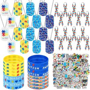 114 Pcs Autism Awareness Dog Tags Set Colorful Puzzle Pieces Motivational Autism Accessories with Acrylic Dog Tags, Rubber Bracelet, Ribbons Pins, Chain, Stickers for Charity Fundraising
KWD 5.500
114 Pcs Autism Awareness Dog Tags Set Colorful Puzzle Pieces Motivational Autism Accessories with Acrylic Dog Tags, Rubber Bracelet, Ribbons Pins, Chain, Stickers for Charity Fundraising
KWD 5.500
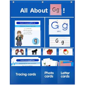 All About Letter Pocket Chart, Alphabet Wall Chart Wall Chart ABC Flash Cards, Handwriting Practice Letter Tracing for Homeschool Preschool Kindergarten| 34" x 27"
KWD 11.500
All About Letter Pocket Chart, Alphabet Wall Chart Wall Chart ABC Flash Cards, Handwriting Practice Letter Tracing for Homeschool Preschool Kindergarten| 34" x 27"
KWD 11.500
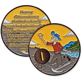 Gaunt Prospector AA Medallion 1 to 60 Years Sobriety Gift with Coin Capsule
KWD 9
Gaunt Prospector AA Medallion 1 to 60 Years Sobriety Gift with Coin Capsule
KWD 9
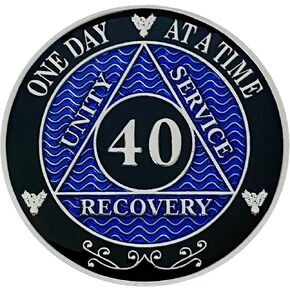 Simply Minimal AA 40 Year Recovery Silver Color Plated Medallions Alcoholics Anonymous Coins
KWD 9
Simply Minimal AA 40 Year Recovery Silver Color Plated Medallions Alcoholics Anonymous Coins
KWD 9


